Homes, commercial buildings & multi-family properties
Homes, offices, clinics, hospitals, hotels, schools, condos, apartments and heritage buildings.
Visible roof, façade, cladding, glazing, parapet, balcony and drainage condition; exterior imagery supports owners, contractors and engineers, not a complete interior or structural inspection.
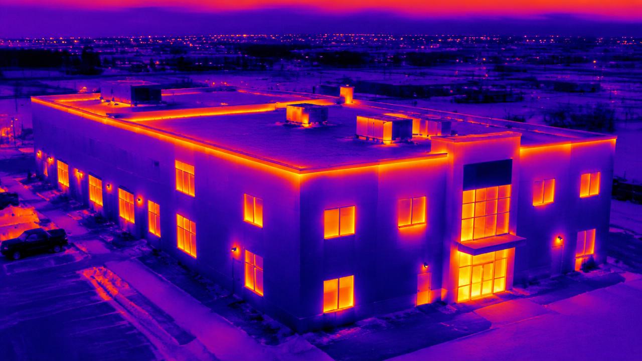
Building envelope, roof moisture & equipment thermography
Insulation, exterior joints, flat roofs, rooftop HVAC, transformers and electrical equipment.
Thermal surveys flag surface-temperature anomalies under suitable environmental and load conditions. Suspected moisture, heat loss or equipment faults need specialist validation; this is not a pressure or structural stress test.
Industrial facilities, towers, stacks & storage structures
Factories, telecom towers, chimneys, stacks, grain elevators, bins and accessible tank exteriors.
Document visible corrosion, coating deterioration, cracks and accessible exterior components. Tank internals, wall thickness and weld integrity require separate specialist methods; shutdown and stand-off requirements are site-specific.
Powerlines, substations & pipeline rights-of-way
Poles, overhead line components, substations, exposed pipeline assets and surface corridors.
Visible condition, vegetation encroachment and erosion documentation, with thermal capture where scoped. Aerial imagery does not establish buried pipe integrity, gas leaks or electrical safety; corridor operations depend on flight permissions.
Solar arrays & wind turbines
Rooftop and ground-mounted solar panels, turbine blades and towers.
Solar temperature anomalies and visible turbine surface damage can guide maintenance. Solar capture needs suitable operating conditions; turbine inspections require operator coordination and an agreed safe shutdown plan.
Bridges, roads, rail corridors & civil infrastructure
Accessible bridge surfaces, road embankments, rail rights-of-way and construction drainage.
Exterior visual records and terrain mapping can support infrastructure professionals. Undersides, bearings, culvert interiors and live transport corridors require a separate access and safety review; imagery does not certify bridge capacity or track safety.
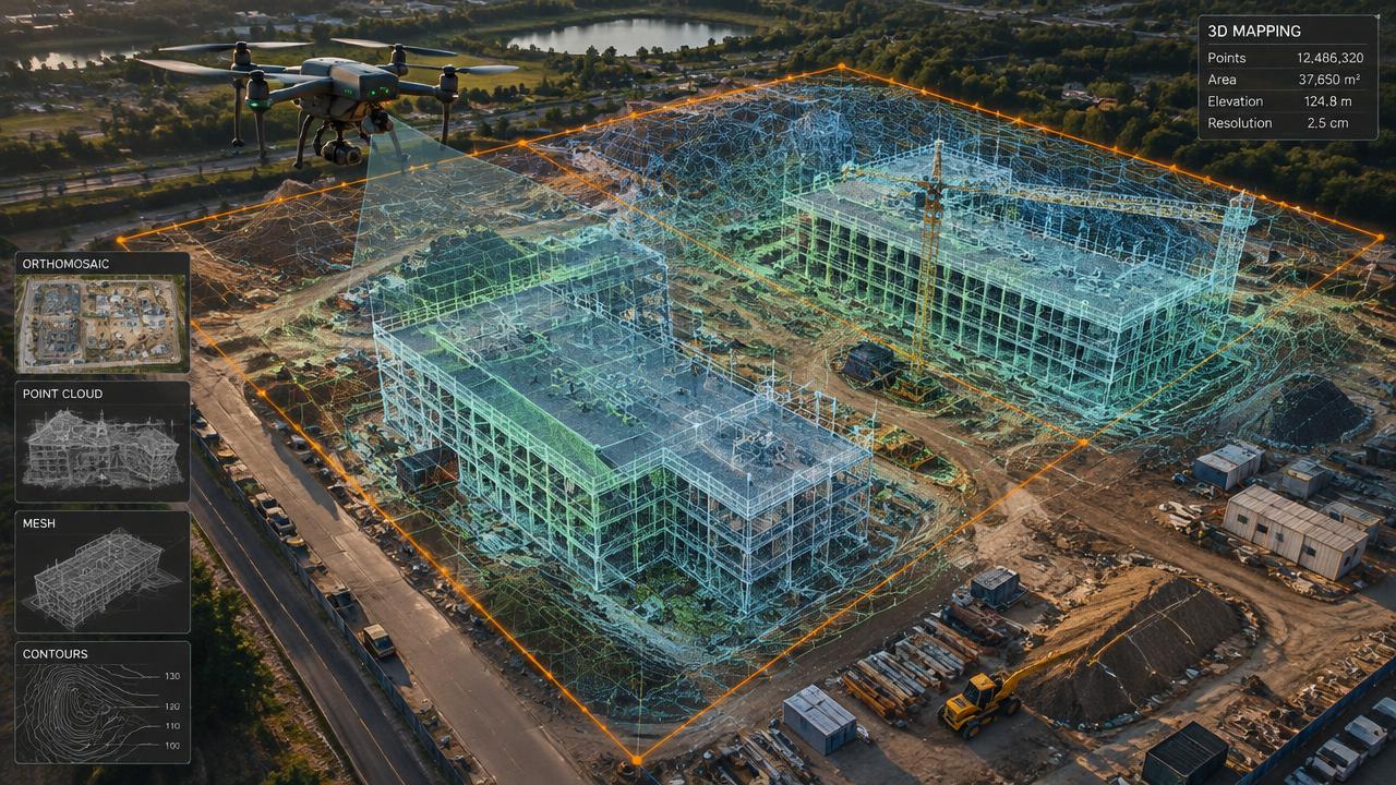
Construction, earthworks, mines & aggregate sites
Building sites, excavations, stockpiles, quarries and reclamation works.
Repeat imagery, 3D models and surface measurements document progress and change. Survey control, accuracy and reporting are agreed per project; data is not a geotechnical stability assessment, safety audit or legal boundary survey.
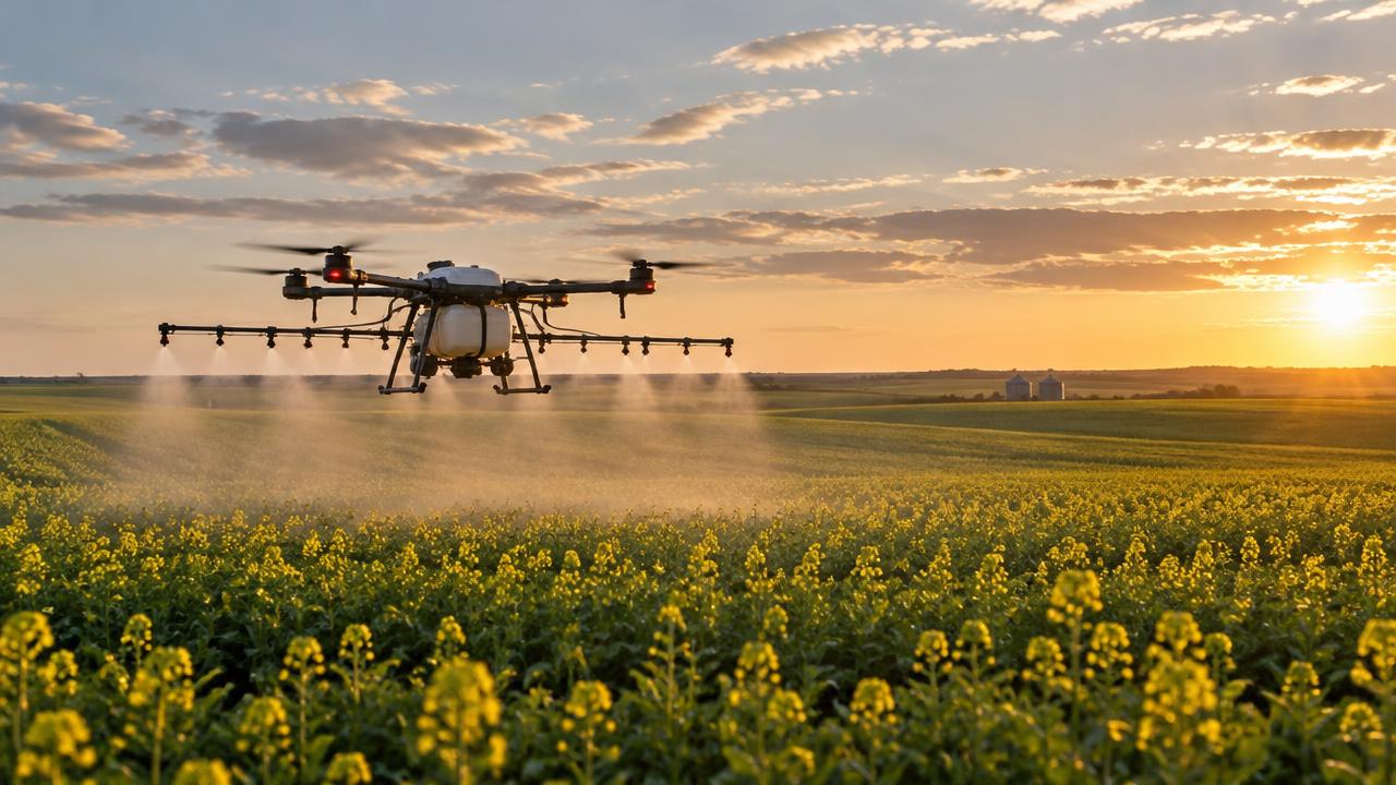
Farms, crops, livestock & agricultural structures
Crop fields, pastures, fences, water sources, barns, bins and grain elevators.
Crop-health maps, livestock sightings, drainage mapping and accessible structure imagery support producers. Multispectral and thermal equipment must be confirmed for the project; crop stress patterns do not identify a disease or prescribe treatment without agronomic review.
Shorelines, wetlands, forestry & water infrastructure
Erosion sites, shorelines, wetlands, reclamation land, drainage basins and accessible dam or reservoir surfaces.
Surface imagery and repeat mapping support change monitoring and environmental consultants. Vegetation can obscure the ground; underwater structures, water quality and dam safety need separate testing or professional assessment.
Storm damage, insurance & property due diligence
Hail- or wind-affected roofs and exteriors, acquisition properties and warranty records.
Capture visible condition and compare available baseline records for owners and adjusters. Imagery does not determine insurance coverage, defect causation or full property compliance.
Specialist inspections — availability unconfirmed
- Sewer, tunnel & gas-hazard interiors
- Our palm-sized drones handle boilers, tanks, ductwork and bridge undersides; sewer, long tunnel and explosive-atmosphere interiors still need separate review of equipment, gas risks and facility permits.
- Ultrasonic, contact & non-destructive testing
- Wall-thickness measurements, weld testing and contact probes require validated equipment and qualified personnel. Standard aerial photos and thermal cameras cannot provide these results; availability is unconfirmed.
- Gas, methane & environmental sampling
- Leak detection, emissions measurement and air or water sampling require dedicated calibrated sensors and an agreed methodology. These are not established by a visual pipeline or environmental survey; availability is unconfirmed.
- Underwater, offshore & hazardous-area inspections
- Submerged assets require underwater equipment; offshore and explosive atmospheres require separate equipment and operational approvals. These specialist services are not confirmed.
Aircraft size and payload capacity do not establish sensor capability, hazardous-area suitability or professional certification. Each project requires an equipment, site and permissions review.
Transport Canada: site surveys and where drones may fly